Contact Seller
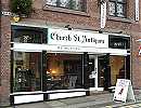
Church Street Antiques
Tel0161 929 5196Please quote Antiques Atlas.


 1750 Plan of Messina Sea Port of Sicily Engraving
 Antique County Map, Rutlandshire, English, Framed
 Antique County Map, Norfolk, English
 Antique Lithography Map, Buckinghamshire, English
 Antique Lithography Map, County Durham, English
 Original 1805 Map of Kent by John Cary Large Size
 1821 Parish of Christ Church Surrey Plan
 George IV Plan of Alnwick
 George IV Plan of Berwick upon Tweed
 Antique Lithography Map, Isle of Thanet, Kent
 Antique Lithography Map, Bedfordshire, English
 Antique Lithography Map, Hertfordshire, English
Non UK callers :
+44 161 929 5196
Map of The Palatine of Cheshire c1695 - R Morden


Map of The Palatine of Cheshire c1695 - R Morden, framed in UV proof glass
24" x 21"(framed)
Robert Morden (c.1650-1703) was an English bookseller, publisher, and maker of maps and globes. He was among the first successful commercial map makers.
Between about 1675 and his death in 1703, he was based under the sign of the Atlas at premises in Cornhill and New Cheapside, London. His cartographical output was large and varied. His best-known maps are those of South Wales, North Wales and the English Counties first published in a new edition of Camden's "Britannia" in 1695, and subsequently reissued in 1722, 1753 and 1772. These maps were based on new information from gentlemen of each county, and were newly engraved. Each had a decorated cartouche, and showed numerous place names.[1] Morden also produced in 1701 a series of smaller county maps often known as Miniature Mordens.
SellerChurch Street Antiques
View all stock from
Church Street Antiques

 4 Old Market Place
Altrincham
Cheshire
WA14 4NP
Tel : 0161 929 5196
Non UK callers : +44 161 929 5196
Get directions to Church Street Antiques
24" x 21"(framed)
Robert Morden (c.1650-1703) was an English bookseller, publisher, and maker of maps and globes. He was among the first successful commercial map makers.
Between about 1675 and his death in 1703, he was based under the sign of the Atlas at premises in Cornhill and New Cheapside, London. His cartographical output was large and varied. His best-known maps are those of South Wales, North Wales and the English Counties first published in a new edition of Camden's "Britannia" in 1695, and subsequently reissued in 1722, 1753 and 1772. These maps were based on new information from gentlemen of each county, and were newly engraved. Each had a decorated cartouche, and showed numerous place names.[1] Morden also produced in 1701 a series of smaller county maps often known as Miniature Mordens.
Price The price has been listed in British Pounds.
Conversion rates as of 8/MAY/2024. Euro & Dollar prices will vary and should only be used as a guide.
Always confirm final price with dealer.
Date 1695
Late 17th Century Antiques Material Paper
Origin English
Maker Robert Morden
Item code as033a806 / 380
Status Sold
£380.00 
$474.73 
€441.64 

$

€

Conversion rates as of 8/MAY/2024. Euro & Dollar prices will vary and should only be used as a guide.
Always confirm final price with dealer.
View all stock from
Church Street Antiques

 4 Old Market Place
Altrincham
Cheshire
WA14 4NP
Tel : 0161 929 5196
Non UK callers : +44 161 929 5196
Get directions to Church Street Antiques
You may also be interested in
 1750 Plan of Messina Sea Port of Sicily Engraving
 Antique County Map, Rutlandshire, English, Framed
 Antique County Map, Norfolk, English
 Antique Lithography Map, Buckinghamshire, English
 Antique Lithography Map, County Durham, English
 Original 1805 Map of Kent by John Cary Large Size
 1821 Parish of Christ Church Surrey Plan
 George IV Plan of Alnwick
 George IV Plan of Berwick upon Tweed
 Antique Lithography Map, Isle of Thanet, Kent
 Antique Lithography Map, Bedfordshire, English
 Antique Lithography Map, Hertfordshire, English


